If you like history, geography and exploring, following the Oregon Trail will give you a most interesting experience where you can easily drift back to a period of American and Canadian history that paralleled the Cariboo Gold Rush (1858 – 1890.)
There are many ways to reach the trail but one way that we followed takes you through several historic areas of exploration and conflict – conflict with native people or nature’s elements.
I bought a map guide book in St. Louis, Missouri which traced in maps and pictures, every inch of the 168-year-old track from Independence, Missouri to the Willamette Valley in Oregon – 2,000 miles.
The thrill of standing in a dry, desolate flat cut by two deep ruts that come into view behind you and disappear in the distance is never to be forgotten. This is living history.
In 1842 there was a severe depression in the crowded eastern U.S. and people were crossing the “wide Missouri River” seeking access to farm land. Horses and oxen-powered land use and travel. The U.S. was pushing westward to the Pacific blocking expansion there by Mexico and Britain (Canada.)
Tales of great areas of lush land, by promoters, led to many wagons of every description heading west into the literal unknown, loaded with everything a family owned.
The tide of wagons grew each spring for the five – six months of travel.
In 1842 – 112 people left for Oregon. In 1843 – 1,000. By 1869, between 250,000 – 500,000 with one in 15 dying along the trail from cholera, carelessness (guns going off in bouncing wagons, children falling under the wheels or being trampled in stampedes of stock), Indian attacks, starvation or despair. There was a death for every 240 feet of trail.
The streams of Conestoga wagons with cattle and horse stock, overgrazed a belt along the trail 30 miles wide which created a huge problem in future settlement.
At the same time, there were great discoveries such as the immense herds of bison, the various native bands, new rivers and the lowest pass through the Rocky Mountains – South Pass in Wyoming, where many routes converged. When we drove through it was hard to tell you were crossing the spine of North America.
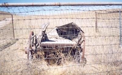
We went south from Lethbridge, Alberta, through Blackfoot territory and the lands of conflict of the U.S. cavalry and the natives, (battle sites are well marked just off the highway) to Billings, Montana (where you can see Clark’s signature on Pompey’s Pillar from the Lewis and Clarke Trail of 1804 – 1806), to little Big Horn and Custer, then east to Nebraska at Scott’s Bluff where we turned west along the trail to Oregon in two weeks. There are many mementoes, of wagons parked over a grave to prevent wild animals from uncovering them, or pieces of discarded furniture or a gravestone.
It’s interesting that the westward move of Mormons began in 1847 with 72 wagons along much the same routes.
Andy Motherwell is an amateur historian and regular Observer columnist.