In recent years, B.C.’s forests and watersheds have been significantly impacted by wildfires, floods, landslides, and pests like the mountain pine beetle. All of these factors have had great environmental and socio-economic impacts on communities across the province.
A new initiative will help researchers explore the impacts of these forest disturbances. The Interior University Research Coalition (IURC) will aid researchers through the Disaster Prevention, Response, Recovery and Resilience (PR3) fund.
The coalition’s ultimate goal is to amplify research on forest disturbances in B.C.’s Interior, where researchers are often on the front lines of disaster events.
Faculty and students at UBC’s Okanagan campus (Kelowna), Thompson Rivers University (Kamloops), and the University of Northern British Columbia (Prince George) have collaborated together to form IURC, and are working on three research projects to examine natural disturbances and their impacts on watershed processes in forests, hillside slopes, and on Crown land.
Janice Larson, director of the Tri-University Partnership Office, which oversees the IURC said the coalition’s goal is to establish inter-institutional and interdisciplinary research teams to address this important and complex research area.
“Climate change and increased land development have emerged as influential factors in the occurrence of wildfires, floods and other natural disasters,” said Larson.
Read More: Wildfires focus of upcoming workshop for B.C.’s community forests
UNBC Professor Stephen Déry teamed up with UNBC and TRU researchers to examine changes in climate and hydrology across key watersheds in the Fraser and Upper Columbia river basins, affected by wildfires in the past two years.
In addition to assessing the impact of fires and other disturbances on watersheds, the researchers aim to better understand how these disasters have affected Indigenous people’s health. Ultimately, the goal is to develop innovative measures to help mitigate future disasters.
“Changes in the land, air and water all affect the inhabitants of B.C.’s Interior,” said Déry. “It is essential to gauge how floods and drought impact the lives of British Columbians, particularly First Nations, who live off the land and water.”
UBC Okanagan Professor Adam Wei joins Déry and TRU’s Tom Pypker in examining the long-term effects of forest disturbances on forest hydrological systems.
Forests are critical elements in our aquatic ecosystems, said Wei, and large-scale disturbances of our forests can increase stream flow and soil erosion, leading to floods, landslides and other hazards that affect Interior communities. There are currently no identified thresholds for large forest landscapes or watersheds in B.C. or elsewhere and there are no studies on forest disturbance thresholds for peak or low flows.
“The results from this proposed research will greatly advance watershed science and provide timely results that will help B.C. manage forest disturbances and reduce or minimize severe hydrological hazards,” said Wei.
Read More: Provincial land use planning through the Fraser Watershed Initiative
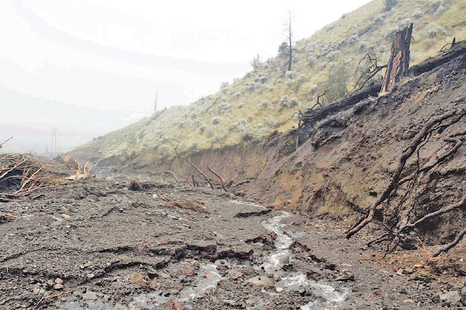
A final IURC project will examine how wildfires and climate change have increased the risk of landslides in B.C.
Dwayne Tannant is a Professor of Civil Engineering at UBC Okanagan and notes that assessing landslides is problematic due to the unstable nature of slope regions.
The project will use unmanned aerial vehicles (UAVs) to perform 3D mapping of landslide areas in co-operation with Tolko, Crystal Huscroft and John Church (TRU), and Joseph Shea (UNBC).
Images acquired from the UAVs will then be used to visualize geomorphic features and measure landslide geometry and movement. Previous attempts to measure landslides have been unsuccessful, as tools can be destroyed by moving earth.
“Landslides, by their nature, are dangerous places to work and many areas are inaccessible,” said Tannant. “We believe that UAVs will prove to be excellent tools for assessing burn intensity, soil types and slope gradients and allow us to create accurate hazard maps for debris and mudflows.”
Larson said that this is only the start of what the three Interior universities are capable of achieving when they work together to tackle pressing challenges in the region.
The PR3 funding was awarded earlier this month and all three research teams expect to see results over the next two years.
raven.nyman@100milefreepress.net
Like us on Facebook and follow us on Twitter.