The City of Quesnel is keeping a close eye on Baker Creek this week, with the water running high and fast.
Director of emergency services Sylvain Gauthier says he and the city’s public works staff are checking on the creek every few hours.
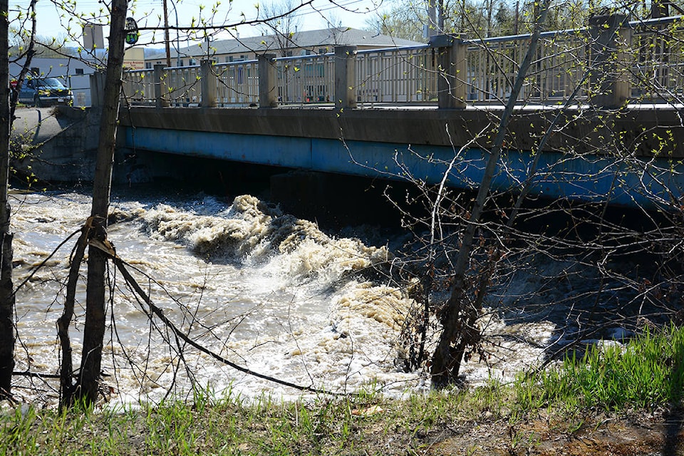
“Baker Creek normally gets to this level in the middle of May, so we are almost two weeks ahead due to high water levels in Baker Creek reservoir,” he says.
Gauthier met with city manager Byron Johnson; Jeff Norburn, who runs the Emergency Support Services; and other city staff this morning to evaluate flood risks, after sitting in on a call with the Provincial Emergency Program in Prince George, the province’s water stewardship division, the River Forecast Centre and Environment Canada.
“As per usual, the City of Quesnel has two areas that flood regularly, which are the Johnston Bridge Loop, which we have closed already due to high water, and also the loop on the west side, on North Fraser Drive. There is still a lot of room before we have to block that road,” says Gauthier.
Both city manager Johnson and Gauthier agree that one of the biggest issues is the debris coming down Baker Creek.
“We are checking Baker Creek every couple of hours so that if there is a log jam, we can bring our contractor in to take care of that. If we get a log jam, it’s amazing how quickly it backs up,” says Gauthier.
“We are monitoring not quite around the clock, but getting close.”
The slightly cooler temperatures are helping keep the creek at a stable level this week, keeping the snow from melting quickly in the mountains. But Environment Canada is predicting warmer weather heading into the weekend, in the mid-20s.
“Higher temperatures will bring more snow melt from the higher elevations, which could create potential risk of flooding,” says Gauthier.
City manager Johnson says they are prepared to put up temporary diking if need be.
“If we need to engage in flood control or diking, we will put up temporary things, which we can source quickly from the province,” he says.
Gauthier says areas that could be vulnerable include Hill Street, off Baker Drive in West Quesnel.
“The west side of Baker Creek I think will be OK, it will just affect the trail, which has already been closed as a safety precaution.
“Depending how high Baker Creek goes, if it goes another foot and a half and we have to put some diking, it might be about five or six residences on Hill Street [that are affected]. We just have to watch the water level. I don’t anticipate it will rise that much, but if something happens upstream, a blockage goes off and there is a surge of water, it will create problems,” explains Gauthier.
Other areas that could be impacted are the mobile home parks on North Fraser Drive, and homes on Rolph Street, along the Fraser River.
Just outside of city boundaries, Cariboo Regional District staff are keeping tabs on water levels in the Quesnel River, with Williams Subdivision one neighbourhood identified as vulnerable to flood waters.
“This is just north of downtown Quesnel, and includes Hazel Road and River Park Road,” says Emily Epp, CRD manager of communications.
“It’s part of the CRD and it is one of the areas we are keeping an eye on with assistance from the City of Quesnel.”
Gauthier says his team are monitoring the water closely, and he will meet again with the city manager and other city staff on Thursday to re-evaluate.
“We make decisions as we go. Currently, there is no need to activate our emergency operations centre,” he says.
The City of Quesnel has set up its Emergency Reception Centre at the Quesnel & District Arts and Recreation Centre, but only to support evacuees from the Nazko Valley.
City of Quesnel officials are urging residents to stay away from the rivers and creeks, keeping at least three-feet from the banks.
“If you get too close, there is the danger of the ground eroding from underneath you,” warns Gauthier.