The City of Quesnel is becoming better prepared to protect the community and make better decisions thanks to new information through a project to update its floodplain mapping.
Quesnel is vulnerable to high water events in the Fraser and Quesnel Rivers, which can cause flooding due to backwater along Baker Creek.
The current floodplain area and levels were set in 1989 by the Ministry of Environment. Up to 2003, the Ministry of Environment held the authority to vary flood construction levels, but the Flood Hazard Protection Statues Amendment Act repealed this involvement, and flood levels are now a local matter, according to the City’s website.
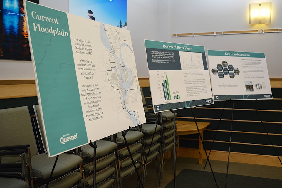
The City of Quesnel is undertaking a floodplain mapping project to assess flood risks, prepare flood maps and develop plans to protect the community from flooding. The City hosted an information session about the project Monday, March 9 at City Hall.
This floodplain mapping project is grant-funded by the National Disaster Mitigation Program, and Urban Systems has been hired to lead this project.
The existing floodplain mapping for the City of Quesnel was developed in 1992 and made use of peak flow data that was available at that time. An additional 25 years of data is available to update the peak flow estimates, and the impacts of climate change are being considered now. These factors are revealing different design flows than those calculated in the early 1990s, according to the City.
“The reason [this project] is important is because our floodplain data was from 1992, and it would be negligent of us not to see what new, improved data we have in terms of looking at and analyzing our floodplain data,” said Tanya Turner, the City’s director of development services. “We make decisions for development based on the floodplain, we make decisions for emergency planning based on the floodplain, so it’s good practice to make sure we are looking at and updating the information and making sure we have done a good job of looking at the best available scientific information that’s going to provide us with the most reliable data. The overall objective is to decrease the community’s risk for being subjected to floods and our residents’ risk of developing and having investments in areas that are prone. The only way you can assist them with those decisions is to give them better data.”
In reviewing river flows, Urban Systems found the Quesnel River flows went down slightly, because the last 30 years of flows indicate there have not been as many high-flow events. That brings the average peak down. The Fraser River flow increased since the 1992 analysis. A recent, separate Fraser River flow analysis as part of the bridge pier scour review calculated the river’s flow to be almost the same as the 2019 analysis, according to Urban Systems.
With this project, Urban Systems analyzed different climate change models. Four of the six climate change models projected minimal changes to the Fraser River over time, while two of them projected a 20- to 30-per-cent increase in flow.
“Each of these climate models is equally likely to be ‘correct,’ so which climate model to apply must involve a conversation about risk,” according to the engineers’ information boards.
Quesnel council has chosen to include a 20-per-cent increase in flows due to climate change in floodplain mapping and in planning.
“Some of the most important information that came out of this is once we looked through all the scientific data that was accumulated … with all that information put together with all the way higher capabilities for putting all this information together and analyzing it and coming up with flows and floodplain impacts, what we ended up with was a floodplain, after you consider the 20-per-cent increase in flow rates due to climate change, that is not that significantly different overall for the community as what we had previously,” said Turner. “There’s some better data on a site-by-site basis, I would say. There are areas that show that they are probably not going to be impacted by flood that we assumed were before, so that’s a big difference. There are areas that we actually have better information on and although they might have been in the floodplain before, we understand they might even have a higher level of flooding than we might have anticipated before, so that’s going to affect our decisions on how to develop and how to do our emergency planning.”
Quesnel’s fire chief and fire inspector have been reviewing this project as well, noted Turner.
“Their better understanding of this is going to make their decisions on how they prepare for flooding — it will change some of their decisions and make their decisions much more informed,” she said.
City staff will now take this updated floodplain map and data back to council, and the City will be updating its floodplain bylaw and related policies and procedures, explained Turner.
For more information about the City’s floodplain mapping, including the information boards from Monday’s information session, visit quesnel.ca/city-hall/major-initiatives/floodplain-mapping.
READ MORE: Spring flooding a risk as Bella Coola snowpack at 36% above normal
editor@quesnelobserver.com
Like us on Facebook and follow us on Twitter