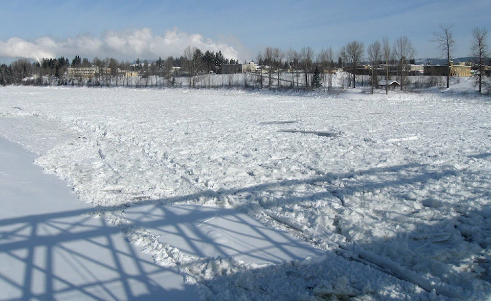
The mountainous snow banks that line Quesnel’s roads and have built up in the city’s parking lot are a testament to just how much snowfall we’ve received this year.
The March 1 Snow Survey and Water Supply Bulletin, though, indicates that the snow pack up in the mountains is only just higher than normal for the Middle Fraser region.
As of Mar. 1, snow pack in the Middle Fraser was at 108 per cent of normal. This will continue to increase until about mid-April, says Dave Campbell, the head of the British Columbia River Forecast Centre.
He says the current findings are within a typical range for this region. The current data on Green Mountain, for example, shows this year’s amount of snow closely tracking the historical average.
The 2017 snow pack was significantly lower, at 84 per cent of normal. This, coupled with last year’s low precipitation rates throughout the spring and summer, contributed to the devastating wildfires.
Campbell says we are in a La Niña cycle, when sea surface temperatures in the central Pacific Ocean drop to lower-than-normal temperatures, causing more precipitation. This contributed to higher snow pack.
He expects to see the melt begin in the highest elevations in about mid-April or early May.
Much of the snow on the plateau areas will be gone by the end of May or June, he explains. The Middle Fraser region has many plateau areas, which are at a mid-elevation and therefore more sensitive to changes in temperature.
“If it’s a couple of degrees warmer, it can really affect the mid-elevation area. We’ve seen those changes over the past 30 years or more,” says Campbell.
The snow pack levels are used to give an idea of whether there are risks of floods, but the weather is what really drives what will happen.
“Do we get heavy rain and hot weather, or is it cold and moderate and the snow melts off in an orderly fashion? Flood is definitely possible during the melt season.”
Campbells comments that regional diking infrastructure is built with this in mind, however.
“The infrastructure is built for certain expected flows that might be there. They are intended to protect against extreme flows.”
The volume runoff forecast as of March 28 is predicting 97 per cent of normal for the Quesnel River. Campbell says the runoff forecast takes into account the amount of snow pack, current stream flows and predicted precipitation – based on historical data and taking into account indices for La Niña as well as Quesnel’s last three months’ weather.
The Parliamentary Secretary for Emergency Preparedness Jennifer Rice today (Mar. 14) released a statement encouraging British Columbians to develop household plans for floods and put together emergency kits, just in case. You can learn about the emegency response plan for each area here.
“Wildfire charred landscapes may lead to increased run-ff and put homes at risk from flooding or landslides,” says Rice.
The statement says the Ministry of Forests, Lands, Natural Resource Operations and Rural Development is reviewing mitigation proposals for construction of protective earthen berms, creek channelization or debris retention basins, and ensuring bridges and culverts are ready.
As the snow pack melts, it will contribute to soil moisture and fill pools, which is positive for local ranchers and farmers.
“This year is in the range of normal. We don’t think it will lead to early potential for drought. If it does flip to extremely dry weather, that will change,” says Campbell.
He noted that wildfire-affected areas are also seeing higher levels of snow pack due to the snow that would normally sit on the canopy – a canopy that no longer exists – falling to the ground this season.
The River Forecast Centre takes readings from a number of automated snow survey sites, and Campbell admitted that some readings in some regions were much higher than average.
There are six survey sites in the Middle Fraser region, at Green Mountain, Mission Ridge, Boss Mountain Mine, Downton/Lajoie Upper, North Tyaughton and Yanks Peak East.
Campbell says overall, snow pack levels are trending down.
“We have seen a general trend towards less snow pack because of shifting climates over the last 100 years.”