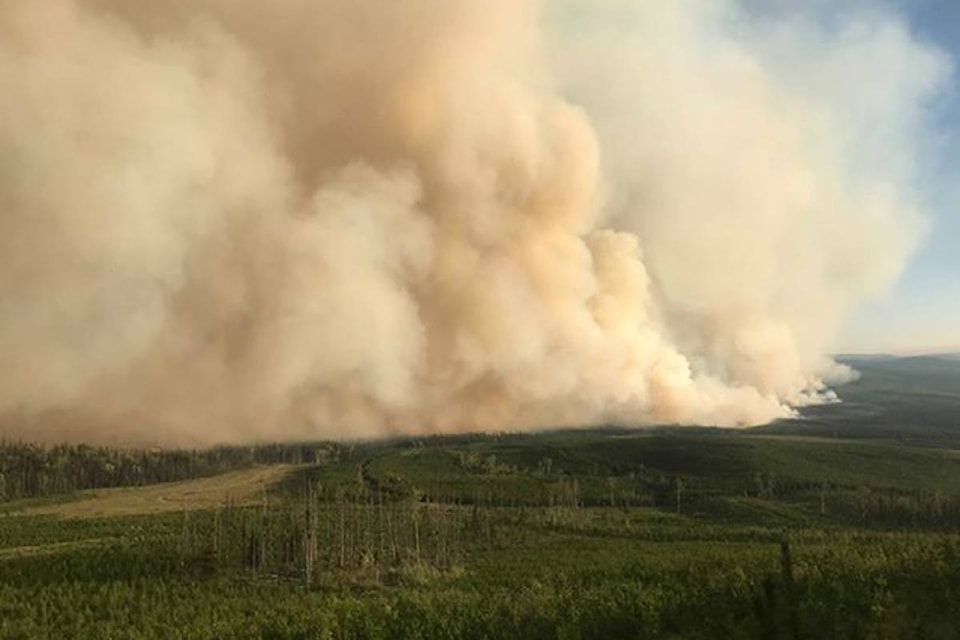
Fires in the Baezaeko Complex have burned more than 36,000 hectares since they were started earlier this month.
Three out of the four fires have been less active in part due to precipitation over the last few days. The North Baezaeko Fire received the least precipitation and it has also shown the most fire activity in recent days.
The North Baezaeko Fire, located approximately 85 kilometres west of Quesnel and south of Kluskoil Lake Park, remains mapped at 11,508.7 hectares. It 40 per cent guarded and 15 per cent contained. Containment is achieved when there are no fuels to burn in between the fire and the fire guard.
Today, crews are continuing to secure the south side of the Blackwater River and the 6600 Road. They are also working to establish a line north of the Blackwater River. Preparations for a planned ignition on the north west flank of the fire is also under way.
There are 69 firefighters (up from 62 yesterday) and 42 heavy equipment on site. There are also 1o helicopters shared between all four fires in the Baezaeko Complex.
READ MORE: Narcosli Creek Fire containment creeps up to 80%
The Narcosli Creek Fire, located 31 kilometres south west of Quesnel, remains under control. The fire size shows an increase from 4,517 hectares to 4,939 hectares due to more accurate mapping. It is 100 per cent guarded and 80 per cent contained. A fire is considered under control when it has received sufficient suppression action to ensure no further spread of the fire.
Crews continue to work on danger tree assessments and falling to ensure safe mop-up operations. There are 31 firefighters (down from 41 yesterday) and no heavy equipment (reduced from two yesterday) on site.
The Blackwater River Fire, located approximately 72 kilometres west of Quesnel and east of the Blackwater River, remains 60 per cent contained and 100 per cent guarded. It is still mapped at 8,364.7 hectares in size.
Crews are working to establish a control line along the south west line, and danger tree assessing and falling will also be carried out along the south west side. Hot spots are being identified on the scan map and actioned by the crews. There are 28 firefighters (up one from yesterday) and six pieces of heavy equipment (down from seven yesterday).
The Shag Creek Fire, located west of Shag Creek and north of Itcha Ilgachuz Park, is now mapped a 12,322 hectares, matching the estimate from yesterday. An aerial assessment of this fire was completed yesterday, Aug. 30. There appears to have been little to no growth. This fire is a modified response fire and is currently being monitored by air only. All primary structures in the area remain intact.
To the north of the North Baezaeko and Blackwater River Fires, the Chutanli Lake Fire is also burning partially in the Cariboo and the Quesnel Fire Zone. It is currently estimated at 20,412 hectares in size, up from an estimate of 20,343 hectares yesterday. It remains 60 per cent contained.
READ MORE: Evacuation alerts, orders downgraded in areas near Nazko
Crews are continuing to work on strengthening guards in the north to ensure that the fire does not head east. When it is safe to do so, they will begin work to the south and south east of the fire.
There are 70 firefighters working at this fire (down from 86 yesterday) and 19 pieces of heavy equipment (reduced from 39 yesterday).
Outside of the Baezaeko Complex fires, there is only one out of control fire in the Quesnel Fire Zone. The Yuzkli Lake Fire, located south of Big Valley Creek, is still 162 hectares in size. It is being monitored by the BC Wildfire Service.
This morning the Cariboo Fire Centre also released statistics on the number of fires started in the Cariboo between April 1 and Aug. 30, 2018.
Since April 1, the 305 fires started in the Cariboo have burned more than 63,000 hectares as of Aug. 30.
Of those fires, 23 of them were human caused, 27 are of an undetermined cause, and 255 fires were lightning caused.
In comparison, between April 1 and Aug. 30, 2017, 268 fires in the Cariboo had burned more than 816,000 hectares. Sixty-three of them were human caused, three where of an undetermined cause, and 202 were lightning caused.
heather.norman@quesnelobserver.com
Like us on Facebook